Heavy rain and strong winds are expected for much of the country during the first week of school holidays.
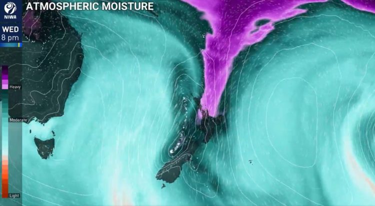
Tuesday should be mostly fine, but more clouds will appear with some rain starting in the southwest by Tuesday afternoon. Meteorologist Lewis Ferris said the worst weather will likely happen on Wednesday and Thursday. Heavy rain is expected in the upper South Island on Wednesday night, then moving to the upper North Island.
There are heavy rain watches for western and northern parts of the South Island, which might turn into orange warnings. Parts of the North Island, especially the Bay of Plenty, could also face heavy rain. The rain comes from a low pressure system in the Tasman Sea, bringing warm and humid air. This means warmer temperatures but also a higher chance of heavy rain, along with strong northeasterly winds.
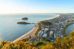
The Bay of Plenty had a dry September, especially Whakatāne, which only saw about 30% of its usual September rainfall. The expected rain from Wednesday night to Thursday could bring more rain than the area has seen this month.
In contrast, colder air will affect the southern half of the South Island, risking snowfall down to about 500 meters in inland Otago and southern Canterbury. These areas might also see heavy rain.
Niwa meteorologist Seth Carrier said more active weather would begin on Wednesday, with a moisture surge leading to heavy rain in the top of the South Island on Wednesday and the north on Wednesday night into Thursday morning.
On Tuesday, the weather will be mostly dry across most of the North Island and much of the South Island, except the lower west coast, particularly Fiordland, where rain will start by the afternoon.
Light winds are expected in many regions, with gusty winds in lower North Island areas like Wellington and in higher terrains of the South Island. Temperatures will be generally comfortable, with highs of 17°C in Auckland and Wellington, 18°C in Hamilton, and around 15-20°C in parts of the South Island, including Christchurch and Dunedin.

