


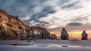

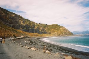
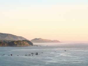


State Highway 35 – The Opotiki, Eastern Bay of Plenty, East Cape to Gisborne road was one of the lesser known roads of New Zealand as in past years it had earned the reputation of being a dusty nightmare. This is no longer true as it has been almost completely re-aligned and is fully sealed, making it a comfortable road now part of the Pacific Coast Highway. Petrol, accommodation and meals are obtainable at regular intervals. Any driver can make this trip with complete confidence and will agree with others who have said that the coastal scenery encountered is beyond compare.
Tablelands
- Kilometres from Opotiki: 3km
- Kilometres from Gisborne: 331.4km
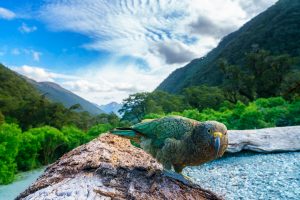
Turn right up Gows Road (or continue to Hukuwai Beach & turn up Beach Road) you arrive on Tablelands area with magnificent views over the East Cape, town area and the Otara Valley. This is also the main orchard area and in season you will have an opportunity to sample locally grown produce. Continuing on Tablelands Road you will find Cape View Cottage and there is a reserve of native forest remnant. Discover what 65 million years of isolation has done to the unique flora and fauna of New Zealand. Bryn-hyfryd is a privately owned conservation area located at 729 Tablelands Road. Guided walks available on well formed tracks. Ancient trees, native fish, songbirds and more. Night time glow worm walks available throughout summer. The predominant trees are puriri, tawa and rewarewa with many miro, hineau, nikau palms, tree ferns, some rimu and other species. Native Orchards are also to be seen in season. To protect ground-nesting birds, any dogs must be on a leash.
Hukuwai Beach
- Kilometres from Opotiki: 3.5km
- Kilometres from Gisborne: 330.9km
This is a popular and safe swimming beach. Here surf casting and long-line fishing is often well rewarded. There is a good picnic area with toilet facilities. Walking the beach and beach-combing can prove very interesting. You can also join the “Dunes Section” of the MOTU TRAILS CYCLEWAY from here. The small hills rising on the right-hand side of the road were once the sites of pre-Pakeha native villages. Turning right on to Beach Road, you will climb onto Tablelands.
Tirohanga
- Kilometres from Opotiki: 6km
- Kilometres from Gisborne: 328.4km
Continuation of sandy beach and sand dunes, close to the road. Good surf fishing and swimming. The Tirohanga Bluff, a hill on the seaward side of the road, has an old Maori fortification on top where old trenches are easily discernible. The camping grounds have up-to-date modern cooking and ablution blocks and the owners offer every assistance to campers.
Waiaua River / Motu Road Scenic Detour
- Kilometres from Opotiki: 11.4km
- Kilometres from Gisborne: 323km
Cross the Waiaua River and turn right for the Motu Road to Matawai via Toa Toa and Motu. Three kms on the left are the Waiaua Church & Marae. As a contrast to the coastal scenery and easy driving on SH35 the old Motu coach road provides a more challenging drive on metalled road through some of the best rugged bush-clad mountainous country in New Zealand. Toa Toa – Valley of the Clouds, some 40km from Opotiki, now a quiet backwater, once supported a thriving community with timber mills, cheese factory, post office and school. Continue on to Matawai by veering right at Toa Toa.
A detour at the Motu Falls – well signposted – will prove rewarding. With good amenities the falls is an ideal place for a picnic lunch. Allow the best part of a day for the 140-odd km round trip back to Opotiki via the Waioeka Gorge or continue on from Matawai to Gisborne.
Omarumutu
- Kilometres from Opotiki: 12.8km
- Kilometres from Gisborne: 321.6km
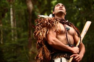
This is the site of the Omarumutu War Memorial Hall, the interior decoration of which belongs with the finest Maori art in the country. The Tutamure meeting-house reveres the ancestral chief of the present Ngati Rua sub-tribe of Whakatohea, who attacked and won his battle with Kahungunu at Te Mahia Peninsula. The original pa sites of Tutamure may still be seen today at Rahui. The Makeo peak, behind Omarumutu, was one of his strongholds.
Opape
- Kilometres from Opotiki: 17.6km
- Kilometres from Gisborne: 316.8km
This is where the sandy beach ends amid the rocky inlets. Small fishing boats may be launched here to seek their way through the channel to the open sea. Eastern boundary of the Whakatohea tribe, Opape is the site of the Muruwai meeting-house overlooking the sea. Here visitors can find a well equipped camping ground set well back off the main road and a newly developed coastal walkway.
Torere
- Kilometres from Opotiki: 24km
- Kilometres from Gisborne: 310.4km
A large semi-circular bay, rocky at each extremity, and with a steeply shelving pebble beach, with deep water close to shore. Unsuitable for swimming but ideal for fishing. A lovely picnic area is situated on the western side of the bay beneath large pohutukawa trees. At the eastern end of the Bay the Bookbinders Road leads to some historic walkways, which include evidence of early Maori settlement on top of the hill and a whaling oven along the beachfront below the hill. This is private property so a phone call would be a wise move.
A richly decorated church, serving the local Ngaitai tribe here, is worth inspecting, and the key can be collected at the nearby Runanga office where you will be directed to local points of interest and the various cottage industries. As you drive up the hill take time to see the magnificently carved Whakairo Gateway to Torere School.The Ngaitai tribe of Torere are descendants of Hotoroa’s daughter, Torere, who came ashore from the Tainui canoe on its journey along the coast from Whangaparaoa. The Tainui eventually terminated its journey from Hawaiiki at Kawhia, after being dragged overland from the Waitemata into the Manukau Harbour.
Hawai
- Kilometres from Opotiki: 28.8km
- Kilometres from Gisborne: 305.6km
A similar shelving beach to Torere, bare of trees, and usually covered with driftwood. An excellent fishing spot, however with river swimming and surfing at the eastern end of the beach. This is the boundary area of the Whanau-a-Apanui tribe, which extends to Cape Runaway. Many tribal skirmishes have been reported about here – the old Ngariki tribe has Pa’s in the hills – and the Hawai River, on the eastern side of this area, appears to have been part of one of the old tracks to the Gisborne plains in ancient times.
Maraenui/Haupoto
- Kilometres from Opotiki: 40km
- Kilometres from Gisborne: 294.4km
A 198 metre high Maraenui hill on the coastal road provides look-out spots which give panoramic views of the coast to Opotiki and beyond, and to Te Kaha and Cape Runaway. A narrow strip of private farmland separates the beach from the main road. The beach is stoney and shelves steeply into deep water, another good fishing spot. A side road runs down to the beach. The rivermouth is renowned for kahawai fishing in season and can be reached from both sides. This area was the location of numerous Pa sites along the coastal flats and in the hills behind. During the siege of Te Kaha, this area provided much-needed food supplies for the defenders. Maraenui Pa was attacked by the northern Ngapuhi tribe.
Motu River
- Kilometres from Opotiki: 44.8km
- Kilometres from Gisborne: 289.6km
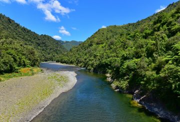
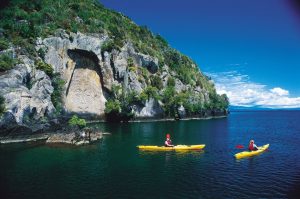
The coastal road from Maraenui runs inland several miles, then crosses the Motu River bridge, and continues along-side the river to pass near the mouth of the river. Just across the bridge is access to the river near which was the camp, used by the men when investigating dam sites for a power scheme on this mighty Motu River, which rises in mountainous country beyond Matawai and falls 487 metres along its 110 km run, and having a catchment area, all in virgin forest, of over 900 square km. The Motu River runs through some of the most awesomely scenic country in New Zealand. Its banks are covered with unique and rare flora such as orchids, koromiko, hebe and native broom in a setting of wild splendour scarcely touched by humans since time began. The entire river is covered by a conservation order, its waters offer the only access to view these scenic wonders. These same waters offer exceptional opportunities for jetboating, whitewater rafting, kayaking and access for hunting.
Whitianga Bay
- Kilometres from Opotiki: 51.2km
- Kilometres from Gisborne: 283.2km
Deep water cove, in one of the most beautiful spots in New Zealand.
Omaio
- Kilometres from Opotiki: 56.8km
- Kilometres from Gisborne: 277.6km
A wide, fairly sheltered bay, with the road running along close to the beach area. The shingle surf beach shelves steeply, and provides good fishing. Some lovely picnic or parking spots here on the western side of the bay towards Pokohinu Point. As you reach the store and cafe you turn onto the Old Coast Road by turning sharp left. This leads past some wonderful carvings on the Marae gateway before continuing to the Hoani Waititi Reserve, with toilets, and many ideal picnic and camping sites.
Little Awanui
- Kilometres from Opotiki: 63.2km
- Kilometres from Gisborne: 271.2km
Sandy, sheltered cove and bay, ideal for picnics or just stopping to admire the view and maybe swim, fish, dive or to go boating.
Te Kaha
- Kilometres from Opotiki: 70.4km
- Kilometres from Gisborne: 264km
Te Kaha (to stand firm) owes its name to the many sieges by invading tribes that it withstood. At Te Kaha Tukaki, a beautifully carved meeting house, and the remains of the old redoubt may be seen. Te Kaha was an old whaling settlement and was the scene of early missionary activities. As the whale numbers decreased, farming activities became the chief source of income for the local people. A dairy company was established but this, in common with other small factories throughout New Zealand, was forced to close and the milk sent on to Opotiki. Te Kaha’s ideal climate has lead to many kiwifruit orchards being established in recent years. A popular vacation area, situated on a headland and surrounded by glorious bays and beaches.
Continuing on the Pacific Coast Highway you will find the Te Kaha RSA and the Te Kaha Beach Resort. On past the Marae you will find the Te Kaha Holiday Park Motels & Café, General Store and Takeaways, overlooking the bay. Maraetai Bay also known as School House Bay, is a safe, sandy sheltered beach for swimming or relaxing and there is a public toilet.
On the left 3km from School House Bay is the Maungaroa Marae with a whale boat on display. This is the historic “Greyhound” that in 1993 was returned to the coast from Gisborne Museum. The ruins of its boat shed can be seen on the beach below the marae. Further on, by the roadside between two lovely pohutukawa trees, is buried Princess Te Rangi Pai and her husband John Howie. The grave is marked with a guardian angel headstone, one of the wings of which was damaged during the Wahine storm of 1968 (the stone has since been repaired). The Howies lived for many years in their home “Kopuakoeaea” at Maungaroa. Mrs Howie was a great celebrity and a famous New Zealand singer who performed before royalty.
Kereu River
- Kilometres from Opotiki: 76km
- Kilometres from Gisborne: 258.4km
Good fishing, picnicing, and relaxing.
Waikawa Point
- Kilometres from Opotiki: 81.6km
- Kilometres from Gisborne: 252.8km
More good fishing, picnicing, and lazing!
Whanarua Bay
- Kilometres from Opotiki: 88km
- Kilometres from Gisborne: 246.4km
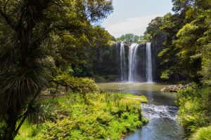
Considered by many to be the prettiest bay on the coast. The climate here, as on so much of the coast, is without equal in New Zealand and as some claim, in the world – Whanarua Bay has its own sub-tropical micro climate. The small beach is ideal for picnics, swimming & snorkelling. As vehicle access is difficult, visitors are requested to take the short walk down to the bay, opposite Pacific Coast Macadamias. There is also a walking track through untouched native forest to a beautiful waterfall, starting at the bridge over the Whanarua Stream. Access is over private land and permission must be obtained from the Park family (Ph. 07-325 2034). This waterfall is Waahitapu (sacred) to local Maori, please treat the track and bush with appropriate respect.
Maraehako Bay
- Kilometres from Opotiki: 89.6km
- Kilometres from Gisborne: 244.8km
Idylic spot with swimming, fishing and boat launching on private property. Unique Location.
Te Waiti
- Kilometres from Opotiki: 94.4km
- Kilometres from Gisborne: 240km
Rock fishing and diving.
Raukokore
- Kilometres from Opotiki: 99.2km
- Kilometres from Gisborne: 235.2km
Easily recognised by the Anglican Church on the promontory and the Catholic Church almost opposite which was once marked by a huge whale bone arch, a relic of the old whaling days. The arch is now housed in the Whakatane Museum where it was placed for safe keeping. Good fishing and a sandy beach near the school.
Waihau Bay
- Kilometres from Opotiki: 107.2km
- Kilometres from Gisborne: 227.2km
A rock-strewn bay where you will find a Post Office store which was founded by James Walker who established his business interests here in the 1870’s. Kea Creations & the Waihau Bay General Store have local information on the coast & activities happening. A deep-sea fishing club with concrete boat ramp has been established & boat charters are available. There are some good fishing spots locally and there is also a local coastguard (VHF Channel 63) manned during daylight hours.
Oruaiti Beach
- Kilometres from Opotiki: 110km
- Kilometres from Gisborne: 224.4km
A safe, sandy, swimming beach, this is considered by many to be the best beach on the East Coast road and the Waihau Bay Holiday Park is only just across the road from the beach where the sand starts.