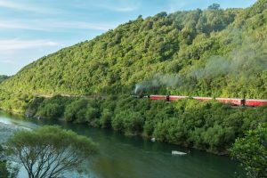
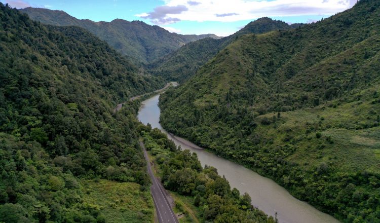
The trip from Opotiki to Gisborne can probably take about two and a half hours but by picnicking or generally messing around anywhere in the delightful bush setting of the gorge the trip can profitably be made to last many hours longer.
Tauranga Track
- Kilometres from Opotiki: 25km
- Kilometres from Gisborne: 119km
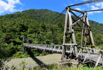
Tauranga Track is on the right side of the road. This is a 2 – 3 hour walk up one of the first farmed areas in our district. It involves two creek crossings so you will get your feet wet. For those who prefer dry feet however at the start of the walk is the recently restored historic and picturesque Tauranga Bridge and is well worth a visit. The gorge continues through Oponae and Wairata, where the Waioeka River turns south and the main road follows the Opato Stream.
Manganuku Bridge
- Kilometres from Opotiki: 47km
- Kilometres from Gisborne: 97km
Keep an eye out for the Manganuku Bridge, just over it on the left is an honesty camping ground administered by D.O.C. that has toilets, barbecues and rubbish disposal. The charge is $7 per night per group. At the eastern end of the camp is the old main highway bridge which was replaced when the highway was realigned many years ago. Soon after the road starts to climb out of the gorge and wind its way up and over Traffords Hill, at 725 metres the high point in the trip, you are now in sheep and cattle country and cross the head waters of the Motu River, a right turn just after the bridge would take you through even more scenic back roads, to Wharekopae, Rere Falls & Rock Slide then onto Eastwoodhill Arboretum, joining SH2 again south of Gisborne. Or continue on the main road to Matawai.
Matawai
- Kilometres from Opotiki: 72km
- Kilometres from Gisborne: 72km
Matawai is a small rural settlement with store/restaurant, cafe and service station.
Before you leave the area turn left in the village and visit Motu and the falls.
Motu Road
MOTU VILLAGE, once a thriving centre of the surrounding district is nestled in the scenic Motu River Valley. Originally seven sawmills provided local industry and employment. Now Motu is a very well established and productive farming community.
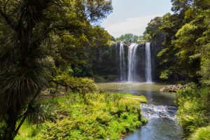
Special attractions include the Motu Falls and the Whinray Reserve Bush Walkwhich is an easy two hour walk along the old Military Track. (this is not a loop track but there is vehicle access from each end of the track).
Or continue on the drive down “Old Motu Coach Road”, the original coach road through Motu and Toa Toa (the valley of the clouds), is an unforgettable experience. The rewards are many with wonderful views and the sense of passing back in time and travelling over what was at one time a major New Zealand highway.
The “Old Motu Coach Road” takes you 64km from Motu to the sea. It is still the same as it was over 40 years ago. This trip down can make an interesting days outing from Opotiki by travelling from Opotiki through the gorge to Matawai, thence on to Motuhora and Motu. A little detour here to the Motu Falls is well worth while and provides an ideal picnic spot. Then drive on to Toa Toa and back to Opotiki. Allow a whole day – it’s worth it, but please drive carefully as it is a road that demands respect.
Otoko
- Kilometres from Opotiki: 91km
- Kilometres from Gisborne: 53km
Near the Otoko Hall you will find the western end of a Heritage Trail Walkway. (The eastern end of this walkway is at Mahaki). This walkway is 5kms in length, follows part of the old Gisborne to Motuhora Railway, taking 2 – 3 hours to complete and is suitable for all age groups. there is a 500m detour to view a picturesque waterfall set amongst native bush that is noted for the kowhai blossom in spring. The walkway is cloased during lambing season (1 August to 23 October).
On the right you will come across Makaretu Road where you will find Haurata High Country Retreat and Farm Walks. As you emerge out of the hill country, with its sheep and cattle stations you enter the fertile Poverty Bay Flats where horticulture, vineyards, orchards and maize growing are the main rural activities.
Ormond
- Kilometres from Opotiki: 122km
- Kilometres from Gisborne: 17km
You will see Eastern Star Orchard on the left just before the village of Ormond.
Makaraka
- Kilometres from Opotiki: 139km
- Kilometres from Gisborne: 5km
Turn left on SH35 to Gisborne & East Cape or right to Wairoa and Napier.
At the intersection with SH2 you will find Roseland Tavern and heading towards Gisborne East Coast Museum of Technology and Showgrounds Park Motor Camp.

