

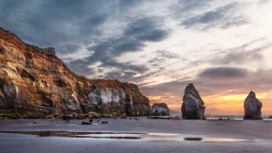


Whangaparaoa (Cape Runaway)
- Kilometres from Opotiki: 118.4km
- Kilometres from Gisborne: 216km
This is the boundary of the Opotiki District and also of the local tribe, Te Whanau-a-Apanui. Take time out to learn some local history and stand where the warriors of the Tainui Canoe first landed at Whangaparaoa Beach. At Number 11442 you will find UMF Manuka Honey. There is a good beach and fishing. Turn off by School to beach and small boat launching. The Cape itself cannot be reached by road. Opposite the School there is an Interdominational church. It is here that two famous canoes landed from Hawaiiki about 1350 A.D. – the Tainui and the Arawa. Other canoes such as the Tauira and Tokomaru are also said to have called at Taungawhaka, this spot is where kumaras were supposedly first introduced to New Zealand. A restored old Pa site and meeting house are of historical interest at Whangaparaoa.
Potaka
- Kilometres from Opotiki: 134km
- Kilometres from Gisborne: 200.4km
Potaka is the most northerly of Ngati Porou communities and is the start of the Ngati Porou tribal area. Here there is a school and a marae, a road to the left runs down to Lottin Point and Lottin Point Motel. The entire length of this public road is bounded by private property and visitors are requested to observe the owner rights.
Lottin Point is well worth a visit. Here we have the serenity of quiet bays and the contrasting rocky coastline with pounding seas. There is good fishing here both for the diver and the surf caster. Just before reaching Hicks Bay you will notice the aptly named Nipple Hill, also the beautiful waterfall in the bush on the right.
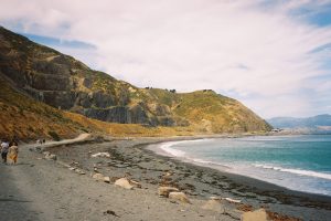
Hicks Bay
- Kilometres from Opotiki: 151.2km
- Kilometres from Gisborne: 183.2km
There is a sudden and dramatic change and this bay, originally named Te Wharekahika and renamed after one of the crew of the “Endeavour” is a truly lovely place. In Ngati Porou history it gains its importance as the place the most famous of Ngati Porou fighting chiefs, Tuwhakairiora first made his home on entry into the area. In times past a freezing works and port were established at the western end of the Bay under the lee of Matakaoa Point. With forestry development on the East Cape, maybe the port will be developed again. Hicks Bay marks the start of the large sheep and cattle stations which extend from here to the south of the North Island along the East Coast and for many miles inland.
Onepoto Bay
At the eastern end is Onepoto Road which leads to Horseshoe Bay (Onepoto) with its cluster of homes and the backpackers lodge. A beautiful quiet secluded bay, 2 minutes from the Hicks Bay Store, it is an ideal safe family recreational beach. Swimming and surfing. Onepoto served as the local boat landing bay pre-European and during early settlement, prior to the Hicks Bay Wharf being established. Fishing charters, waka and horse treks available.
On leaving the flat as you wind up the hill some real views are revealed. Here you come upon the Hicks Bay Motel Lodge on its breath taking site where you will receive a warm welcome. Opposite the motel exit up on the hill is one of New Zealand’s largest puriri trees.
A short journey over the hill, Pukeamaru, with brilliant views leads you down to the Tokata flats, where you will find the well equipped and friendly Te Araroa Holiday Park, a little further on the interesting East Cape Manuka oil plant, shop and cafe is well worth a stop.
Te Araroa
- Kilometres from Opotiki: 160.8km
- Kilometres from Gisborne: 173.6km
A short drive along the flat brings you to the settlement of Te Araroa nestled under the cliffs of the majestic Whetumataerau. Formerly known as Kawakawa-mai-Tawhiti, the name was changed because there were too many Kawakawa’s in New Zealand. The name Te Araroa came from the long hedged path that lead to the house of the 19th century missionary Rev. Kissling. On the beachfront at Te Araroa in the school grounds stands the largest pohutukawa tree in the world, Te Waha o Rerekohu.
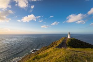
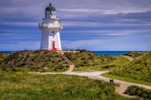
East Cape Lighthouse
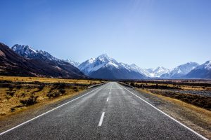
The all weather road runs along the waterfront through private land so beware of stock on the road. The lighthouse is the most easterly in the world and the climb up to the light is well worth the trip. The 40 km round trip is most rewarding done early to see the sunrise.
Tikitiki
- Kilometres from Opotiki: 187.2km
- Kilometres from Gisborne: 147.2km
Tikitiki lies in a valley on the bend in the road and is reached after having driven through some pleasant farmland with areas of forestry development. Tikitiki contains much of interest to the student of the Maori. The people here are descendants of the Whatonga and Toi saga, the first to settle and establish themselves in the fertile valley through which the Waiapu River flows, at the mouth of which fish of many types abound.
Tikitiki has a school, a health centre, a garage, an R.S.A, Postal Centre, Café and Lunchbar.
Above Tikitiki township is the flat hill Pukemaire on which are clearly defined trenches dug in 1864 during the Maori Wars, superimposed on the older earthworks and habitations of the pre-Pakeha era.
St. Mary’s Church at Tikitiki should on no account be missed. The project had to excel all other churches and have Maori architectural design, hereby leading to a resurgence of Maori arts and crafts in the area. The wonderful carvings and Tukutuku woven panels were created by local Ngati Porou craftspeople and the pulpit was a gift from the Te Arawa tribe. Entry to the church is by gold coin donation inside the church.
Ruatoria
- Kilometres from Opotiki: 206.4km
- Kilometres from Gisborne: 128km
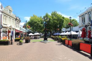
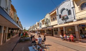
Ruatoria is the largest town since leaving Opotiki and offers facilities not found in other coastal towns so far and is a service centre for many outlying valleys where you will find Kai Kart Takeaways, Ruatoria Hotel, Sharon’s Village Cafe & Crafts, a Westpac bank an R.S.A. Club, and there is a Skate Park & Playground situated on the main road. Further on you will find the well stocked Hikurangi Foodmarket Four Square and Enz of the Earth Guest House Accommodation. Ruatoria has a charm of its own and has important connections with the Maori people, being the centre of the great Ngati Porou tribe. Sir Apirana Ngata lived here and his memory is perpetuated in the Ngata Memorial College.
The Maori V.C. Lieutenant Ngarimu was born here. In the locality there are many natural gas vents. This led to petroleum exploration which made many hopeful but like wells in many other places, these wells were dry. Since 1973 a lot of the marginal farmland has been planted in exotic trees (mainly pinus radiata) which has provided some employment. As well as providing a valuable timber resource the pine trees have helped to stabilise erosion-prone land, and will provide future employment opportunities.
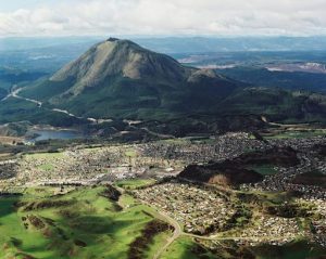
Mt Hikurangi
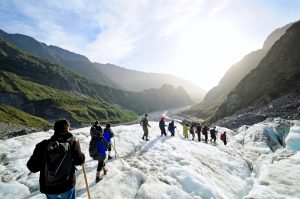
At 1754 metres, the majestic Mt. Hikurangi is the highest non-volcanic peak in the North Island. The mountain is sacred to the Ngati Porou people and is the first place in New Zealand to see the sun each day. High on the mountain are nine carved Whakairo (sculptures) depicting the whanau of Maui – Tikitiki – a – Taranga, who legend attributes to fishing the North Island up from the sea. There is a walking track to the summit via private property, access is by permission of Ngati Porou Tourism who have offices in Ruatoria (ph 06-864 8660).
Waipiro Bay:- A 14km loop road detour off the main road here will take you to Waipiro Bay. Once a bustling coastal shipping township the bay has a school, a fishing ground, three historical Marae and a church.
Te Puia Springs
- Kilometres from Opotiki: 232.8km
- Kilometres from Gisborne: 101.6km
Te Puia Springs is most interesting for here we have evidence of thermal activity. Just north of the village is a pleasant golf course. There is a hospital, and a small but attractive settlement with a well stocked store, hotel and Visitor Information Centre. The surrounding area is interesting and is worth more than a passing glance. A detour off the main road here can take you to Waipiro Bay. Once a bustling coastal shipping township the bay has a school, a fishing ground, three historical Marae & a church.
Tokomaru Bay
- Kilometres from Opotiki: 243.2km
- Kilometres from Gisborne: 91.2km
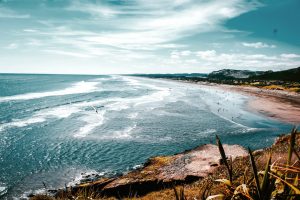
A quiet coastal township with a temperate climate, Tokomaru Bay is a pleasant place. With rocky headlands at each end of eight kilometres of golden beach, it is an ideal place for swimming, surfing and fishing. On the waterfront you will find public toilets & a Skate Park. It is an area rich in culture and history and is known as an arts centre as many craftspeople have been drawn to live there.
The local Maori, Te Whanau-a-Ruataupare have four active marae including the large carved meeting-house on the Pakirikiri Marae which was opened in 1934. A party came down from Rarotonga to take part in the ceremony, hence the name Te Hono ki Rarotonga. The headland Mawhai Pa is known for the stout defence by a small group of old men, women and three European whalers against a much larger party of Hauhau warriors in 1865. At Waima at the eastern end of the bay is an old wharf and the remains of a freezing works which closed down in 1952, relics of the era when transport on the coast was by sea. The New Zealand Shipping Co. had a depot here and the harbour operated until 1963.
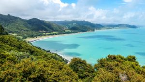
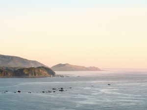
Anaura Bay
- Kilometres from Opotiki: 267km
- Kilometres from Gisborne: 67km
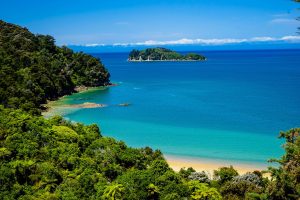
Well worth the 7km drive, Anaura Bay is one of the most beautiful of all the East Cape Bays. Steeped in history, Captain Cook berthed at Anaura where he was warmly welcomed by local Maori, after a speedy retreat from Poverty Bay! Anaura is a very safe haven with a flat golden sanded beach with great fishing. The backdrop of wonderful native bush provides a well formed family walkway of 3.5kms, taking about two hours. An idyllic spot with a good range of all types of accommodation.
Anaura Bay Scenic Reserve: covers 225 hectares of steep bush & regenerating native vegetation. Anaura Bay Walkway begins & ends in the reserve. Camp fees – $10 per site per night. Closed from Easter to Labour Weekend (late October), maximum stay 3 weeks. Facilities – Water from tap. Campers are urged to boil it or bring their own drinking water. A chemical toilet dump station is available & campers must supply their own chemical toilets. Barbecues or fireplaces, picnic tables & rubbish collection may be provided.
Tolaga Bay
- Kilometres from Opotiki: 279.2km
- Kilometres from Gisborne: 55.2km
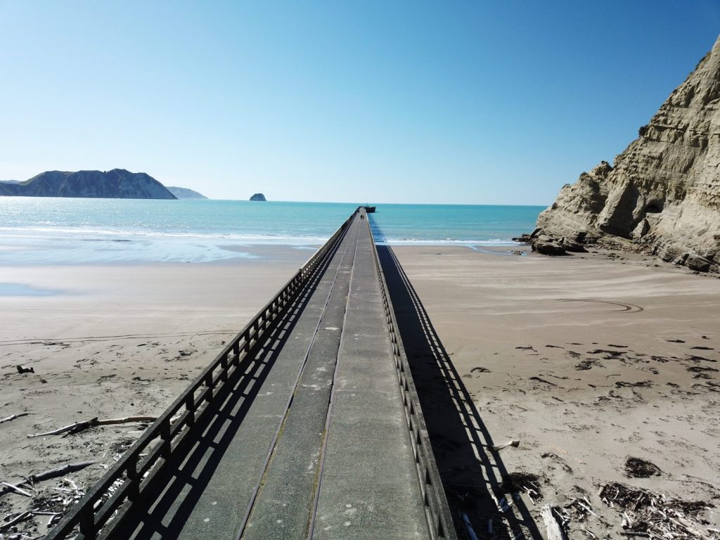
This town is larger than most of the settlements on this coast, and features The Tolaga Inn, a picturesque colonial style hotel, the shopping centre is good and the town boasts a nine-hole golf course, bowling club and skate park. The streets of this town are named after Captain Cook’s crew. Cook cast anchor here in 1769. The beach at Tolaga Bay is excellent for swimming and fishing and adequate facilities are available for boat launching. What is probably the best situated camp site on this coast is The Tolaga Bay Holiday Park about three kilometres out of town, right on the beach at the end of the bay where the rocky shoreline again commences. The very long jetty served as a wharf for the area in the days of coastal shipping. A very popular fishing spot, this is also the start of the 5km Cook’s Cove walkway (2.5 hours) which provides spectacular views of Cook’s Cove and the hole in the cliff wall.
Waihau Beach (also known as Loisels Beach)
- Kilometres from Opotiki: 298km
- Kilometres from Gisborne: 36km
It’s worth taking the time to travel 4.5kms along Waihau Road to view 5.6kms of unspoilt beach nestled in a secluded bay. The beach has a unique combo of safe swimming, great surfing, surfcasting and rocky areas for diving. The beach is alive with dotterell and white-breasted shag colonies. A rewarding day walk along the beach and Old Coach Road leads to the famous Cook’s Cove Walkway and views of Tolaga Bay wharf.
Te Tapuwae o Rongokako Marine Reserve
- Kilometres from Opotiki: 318km
- Kilometres from Gisborne: 16km
(Road access at Pouawa Beach) Marine life is totally protected in this reserve which covers 2450 hectares from the Pouawa to the Waimoko river mouths, and up to 3.5kms offshore.
Tatapouri
- Kilometres from Opotiki: 324km
- Kilometres from Gisborne: 13km
Tatapouri is a fantastic base from which to explore the untouched East Coast. Good fishing and diving may be enjoyed. Wild life mixture include penguins, seals, dolphins, whales and a wide variety of seabirds. Tatapour is in close proximity to several top surfing beaches, is only 10 minutes from Gisborne City’s shops and attractions. Tatapouri is the home of Dive Tatapouri and Tatapouri By The Sea.
After Tatapouri you will pass Makarori Beach, well known as a surfing mecca all year round.
Wainui Beach
- Kilometres from Opotiki: 330.4km
- Kilometres from Gisborne: 4km
Wainui Beach is virtually right in Gisborne, but still retains the peace and restfulness of a country area. The beach is beautiful for swimming and New Zealand renowned for surfing. A left turn at Wairere Road takes you into the settlement of Wainui Beach where you will find Wainui Beach Motel. If you continue along Wairere veering right onto Oneroa Road then left onto Murphy Road takes you to Lloyd George Road andTuahine Cottage. Or if you continue on Oneroa Road you will joint the main highway again.