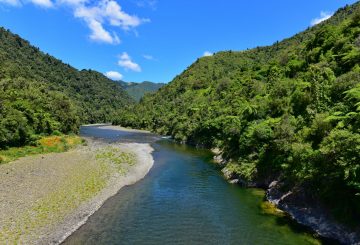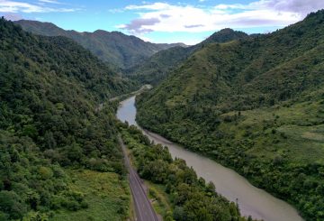
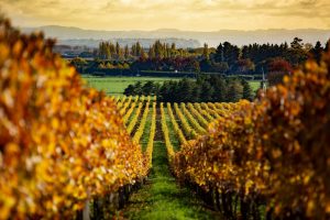


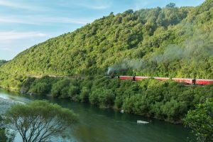


There are two routes from Whakatāne to Ōpōtiki. To join SH2 at Taneatua, a very enjoyable drive for those with a little more time, from the central roundabout by “The Rock”, travel south along Commerce St and Valley Road out of town following the Whakatāne River to Taneatua, a town of historical interest and the gateway to the Te Urewera country. The road continues through the picturesque Waimana Gorge, heading out into the Waimana Valley. To see the Waimana township requires a short detour. When the road reaches Nukuhou turn right off the main road at Bells Road for Celestial Wines and Te Urewera, camping areas and the Lions Hut. The main road continues through pleasant farmland until the Matekerepu bridge just prior to the village of Kutarere, you have then rejoined the “Pacific Coast Highway” described next.
The trip from Whakatāne to Ōpōtiki via SH35, Ōhope Beach & Ōhiwa Harbour
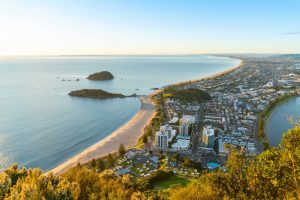
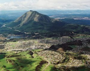
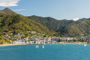
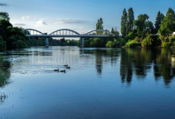
This route is the most direct and most used, you once again start by travelling south along Commerce St, this time turning left up the Mokoroa Gorge. There is an alternative route north along the Strand turning right at the hotel and then right up Hillcrest, this is not recommended for vehicles towing but does provide good views of Whale Island and the Whakatāne Heads. The two routes then merge and head for Ōhope. Before the descent, the view of East Cape, the Eastern Bay of Plenty, Ōhope Beach and Mt Hikurangi on a clear day, is worth a pause.
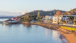
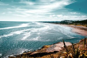
Ōhope Beach
- Kilometres from Ōpōtiki: 50km
- Kilometres from Whakatāne: 8.4km
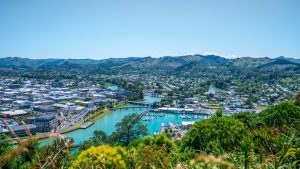
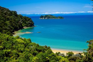
A world renowned holiday spot has 11 km of beach from West End, a favourtie surfing spot, to Ōhiwa Harbour mouth at the eastern end. Ōhope has plenty of holiday accommodation including Beachpoint Apartments and also a small shopping area, a Primary School and a service station Ōhope Autos.
Harbour Road & Ocean Road
The Pacific Coast Highway turns inland at the junction with Harbour Road where you will find Scilla Chocolates and The Sandcastle. Running parallel to the left of Harbour Road is Ocean Road where you will find a local craftsman at No. 66 Woodturning. This sandspit is the western arm of Ōhiwa Harbour. Continuing along Harbour Road there is beach and harbour access, a wharf, boat launching, a holiday park and a golf course.
Pacific Coast Highway
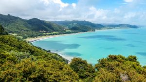
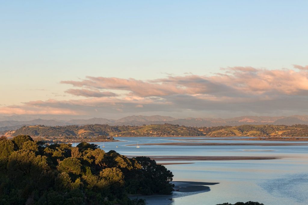
On the Pacific Coast Highway the Ōhiwa Harbour and the Oyster Farm comes into view. This harbour apart from its natural beauty, has great biological significance both for its flora and fauna and is a great source of kaimoana (seafood). Also it has endless potential for recreation.
The road continues to follow the harbour, on the right you pass Te Kooti Road named after a well known historical figure. Further on is the site of the old Wainui School. At Burke Road, next on the left, is a picnic area and boardwalk, affording clear views of the largest remaining salt marsh in the Harbour. Unique displays of the rare birdlife found here, are part of this public facility. The road continues along the edge of the harbour. Turn right up Harrisons Rd to find Ōhiwa Macadamia Farm, which is just before the old Cheddar Valley Co-op Dairy Company building, used for eleven years before amalgamation with Ōpōtiki Co-op. In its heyday it processed the milk from 300 cows and is now used by Cheddar Valley Pottery, which is well worth a visit.
The road then follows the Nukuhou stream till it meets State Highway 2 (S.H.2) at the Matekerepu Bridge. If you take a right turn here on SH2 and travel about 1km you will find Ready Rock Farm. Or a left turn to continue on the Pacific Coast Highway to Kutarere & beyond.
Kutarere
- Kilometres from Ōpōtiki: 20km
- Kilometres from Whakatāne: 30km
The settlement of Kutarere once the port town of Ōhiwa Harbour that serviced the hinterland, is steeped in Māori history with recent major renovations to the local marae.Travelling eastwards still with the harbour on your left, Ruatuna Road provides an interesting detour.
Ōhiwa Harbour Scenic Detour
- Kilometres from Ōpōtiki: 18km
- Kilometres from Whakatāne: 32km
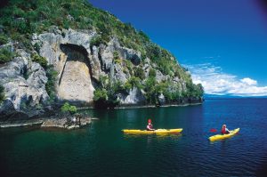
This route follows the harbour edge via Ruatuna road, Ōhiwa Loop Road where you will find Ōhiwa Garden Accessories & Garden, Reeves Road and Ōhiwa Harbour Road and rejoins the Pacific Coast Highway (SH2) at the Waiōtahe River Bridge. On the knoll at the turnoff, occupying an area of 1 to 1.5 hectares are the most northerly New Zealand Black Beech trees, Nothofagus Solanderi. In olden days Ōhiwa was ringed by Pa sites, probably owing to the accessibility of sea food, and was the scene of numerous tribal fights and massacres. Te Kooti died here in 1893 on Hokianga Island in the middle of the harbour. It is a sealed road which leads to many ideal stopping places for safe swimming, windsurfing, waterskiing, canoeing, sailing, fishing, boating, netting, picnics, etc. With low tides, much of the harbour is bared and cockles are easily obtainable, also mussels in season. (Please check for signs as a ban maybe in place.) The Ōhiwa harbour is also the site of the most southerly growing Mangrove plants, and is the only harbour in the country administered by an act of Parliament.
At the end of Reeves Road, turn left on Ōhiwa Harbour Road, which leads to the Ōhiwa spit under the historic Onekawa Pa site. A wharf, the Ferry Hotel, Post Office and school once existed near where the present channel now runs. The area is now a bird sanctuary, with 30 species of birds frequenting the harbour, including the rare migratory Eastern Bar-tailed Godwit. Surf casting at the entrance channel and on the ocean beach is popular. On the way to the Ohiwa Spit you will find, Fantail Cottageand Ōhiwa Family Holiday Park. A right turn at the Reeves road, Ōhiwa Harbour Road intersection leads over the hill to rejoin the Pacific Coast Highway (SH2).
Continuing on the Pacific Coast Highway (SH2) on the right is Waiōtahe Valley Road which travels some 15kms inland, another pleasant drive into the foothills of Te Urewera.
Waiōtahe River and Ōhiwa Beach (Bryans Beach)
- Kilometres from Ōpōtiki: 11.5km
- Kilometres from Whakatāne: 38.5km
At the Waiōtahe River Bridge, turn left. At the first intersection take the right fork alongside the river, this non-exit road leads to the beautifully pohutukawa-lined sandy Ōhiwa (or Bryan’s) Beach, where you will find Dene’s Beachside Accommodation. This secluded spot offers surfcasting, picnicking and safe swimming.
To go to the harbour turn left at the first intersection which takes you over the hill, keep right at the bottom of the hill to find Fantail Cottage and Ōhiwa Beach Holiday Park.
Continuing on the Pacific Coast Highway (SH2) you will then pass the Pipi Beds rest area on the left with toilets, safe swimming and at low tide you can see the locals gathering Pipi’s (shellfish).
Waiōtahe Beach
- Kilometres from Ōpōtiki: 4km
- Kilometres from Whakatāne: 46km
Continuing east along the Pacific Coast Highway (SH2) leading east provides the beautiful spectacle of Waiōtahe Beach with East Cape as a backdrop. This stretch of road when the Pohutukawa trees are in bloom is a magnificent sight. Waiōtahe Beach provides good fishing, surfing and swimming and is probably Ōpōtiki’s most popular beach as there is adequate parking and picnic areas, with plenty of shade.
At the eastern end of the beach you will encounter two magnificently carved poles – Te ara Ki Te Tairawhiti – “The pathway to the sunrise”, designed by Graham Hayward, created by Ōpōtiki’s master carver, Heke Collier, they depict the arrival of the Māori people to Ōpōtiki, with the European Soldier and the Māori Wahine (woman) portraying the togetherness of the races.
Opposite Paerata Ridge Road is the Ōpōtiki Surf Lifesaving Club and public toilets. It is a short run through the Kukumoa cutting to view Ōpōtiki over the Waioeka River. Continuing on the main highway on the right is the Ōpōtiki Golf Club.
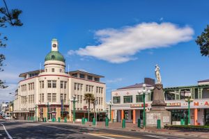
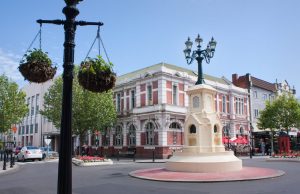
You are now in ŌPŌTIKI. You will find the i-Site Visitor Information Centre on the right at 70 Bridge Street. Turn left at the intersection by SUBWAY to enter the main shopping area.