• New Zealand Regions
      • Hawke's Bay
      • Bay of Plenty
      • Waikato
      • Whanganui
      • Manawatu
      • Northland
      • Auckland
      • Gisborne
      • Taranaki
      • Wellington
      • West Coast
      • Nelson
      • Canterbury
      • Otago
      • Marlborough
      • Southland
      image/svg+xml

      Hawke's Bay

      View Homepage

      Beaches, wineries and Art Deco. The Hawke's Bay has a diverse economy, including business services that support its sectors to be the second largest contributor to regional GDP in the country. A popular tourist destination, the region has some of the countries best restaurants as well as stunning scenery, markets and festivals.

      Districts

      HastingsNapier

      Bay of Plenty

      View Homepage

      The Bay of Plenty is officially New Zealand's sunniest destination, enjoying short-lived winters and long summer days. The Region offers some of the country's most spectacular views and many ways to enjoy the pristine scenery and natural wonders. Visitors also enjoy exploring the Bay's Māori heritage and pre-European roots.

      Districts

      OpotikiOpotiki iSiteKawerauWhakatane

      Waikato

      View Homepage

      The Waikato is known for its rolling plains, fertile land and the mighty Waikato River. The region is the fourth largest regional economy in New Zealand, with a strong focus on primary production and associated manufacturing.

      Districts

      South WaikatoWaikato District

      Whanganui

      View Homepage

      Welcome to Whanganui. This is our place; where history is full of stories, legends and rich legacy. Where a thriving arts scene, creativity and evolving culture inspire our modern lives. Where breath-taking natural landscapes capture imaginations at every turn.

      Manawatu

      View Homepage

      Located in the lower North Island, Manawatu is heartland New Zealand, offering an authentic Kiwi experience.

      The main in the region are Palmerston North, most notable for Massey University. Palmerston has a vibrant, arts and culture scene.

      The region's economy is based on food production and processing, research and education. The region is also home for the New Zealand defence force.

      Northland

      View Homepage

      Northland was originally home to some of our country's first human inhabitants. Today, it is one of the fastest growing regions in New Zealand and home to nearly 189,000 people. Rich in culture and history, the region boasts a stunning natural environment.

      Auckland

      View Homepage

      Auckland Region stretches from the the beaches of the Pacific Ocean in the east to the expansive beaches of the rugged west coast of the Tasman Sea. Auckland City, the largest urban area in New Zealand is considered the main economic center of New Zealand and a popular destination for international students and travellers.

      Gisborne

      View Homepage

      Gisborne is a Region on the east coast of New Zealand's North Island. It's known for wineries and surf beaches such as Makorori. The region has maintained a strong Maori heritage. The region's economy is made up mainly of agriculture, horticulture and forestry.

      Taranaki

      View Homepage

      Taranaki is a coastal and mountainous region on the western side of New Zealand's North Island. Its landscape is dominated by Mount Taranaki, its namesake volcano, which lies within the rainforested Egmont National Park.

      The port city of New Plymouth is the area's cultural and commercial hub. Taranaki's economy is diverse and includes dairy, oil and gas. The region is the highest contributor or national GDP per capita. 

      Wellington

      View Homepage

      The Wellington Region covers Wellington city in the south, Upper and Lower Hutt valleys to the north-east, and Porirua to the north-west. The region takes its name from Wellington, New Zealand's capital city.

      Wellington is famous for its arts and culture scene and is also the centre of New Zealand's film industry.

      West Coast

      View Homepage

      The West Coast, or as some locals call it, the "Wild West", is a long thin region that runs down the South Island's west coast.

      The region has the lowest population in all of New Zealand. It is famous for its rugged natural scenery such as the Pancake Rocks, the Blue Pools of Haast, and the glaciers.

      The main industries in the region are dairy farming and mining. Tourism also plays an important role.

      Nelson – Tasman

      View Homepage

      Nelson Tasman is an extraordinary, vibrant region where art and businesses thrive together among a stunning natural landscape. With one in five people internationally born, Nelson Tasman has 48 different cultures living in its environs.

      The region prides its self on being New Zealand’s leading Research and Development areas, with the highest proportion of people working in the research, science and tech sectors out of anywhere in New Zealand.

      Canterbury

      View Homepage

      Canterbury is a region on New Zealand’s South Island marked by grassy plains, clear lakes and snow-capped mountains. Its largest city, Christchurch, is famed for its art scene and green spaces.

      Otago

      View Homepage

      There are few places in the world which will leave you with a lasting sense of difference. Central Otago is undoubtedly one of them from its landscapes, its seasons, its people, its products and experiences.

      Marlborough

      View Homepage

      Marlborough Region is on the north-eastern corner of the South Island. The region is well known for its winemaking industry, and the Marlborough Sounds, an extensive network of coastal waterways, peninsulas and islands.

      Apart from the wine industry, aquaculture, agriculture and tourism play an important role in the local economy.

      Southland

      View Homepage

      Southland is New Zealand’s most southerly region and includes the World Heritage ranked Fiordland National Park.

      The region's only city Invercargill offers a relaxed pace of life with wide streets, little traffic, spacious parks and gardens, striking Victorian and Edwardian architecture and impressive sporting facilities including New Zealand’s first indoor velodrome. Southland's location is such that views of Aurora Australis or the Southern Lights are common.

      Tooltip

Последнее путешествие по раскрытию секретов недр

Attention: This article was automatically translated and is still waiting on one of our editors to approve the translated content. 
Share:

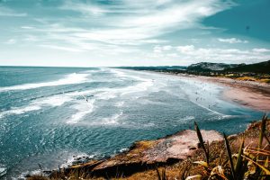
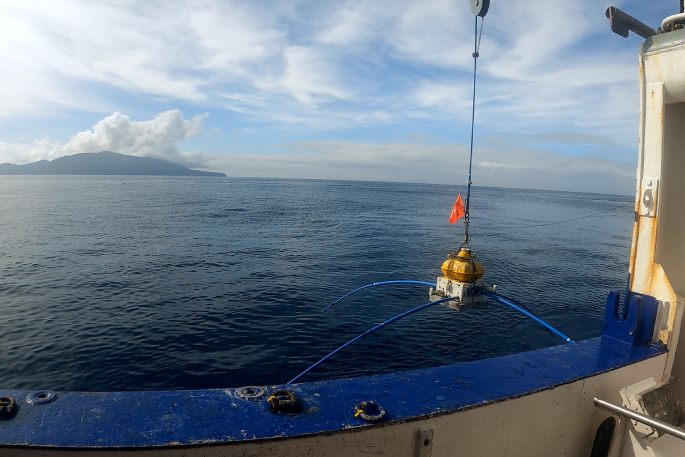
Исследовательское судно Tangaroa отправилось в последнее путешествие по изучению вулканических систем вулканов островов Вакаари/Уайт и Тухуа/Майор. Это часть программы «Под волнами», проводимой компанией GNS Science. Цель состоит в том, чтобы глубже понять триггеры, опасности и последствия потенциальных вулканических явлений, таких как пеплопад, пирокластические потоки, оползни и цунами.

Ученые из GNS Science, Института океанографии им. Скриппса и два амбассадора BLAKE GNS установят оставшиеся 39 из 200 электромагнитных датчиков на дне океана с 28 марта по 12 апреля. Эти датчики позволят получать изображения магматических систем, питающих вулканы, и определять зоны активной гидротермальной вентиляции.

По словам Крейга Миллера, старшего геофизика по вулканам GNS Science и руководителя программы, предыдущие путешествия уже позволили получить новую информацию о частоте, размере и причинах прошлых извержений. Предварительный анализ показал наличие глубоких флюидов, возможно, магмы, к северо-западу от Вакаари. Если это правда, это может повлиять на мониторинг вулкана в будущем. Сейсмическая активность в этом районе может указывать на повышение вулканической активности.

Предварительные результаты проб донных отложений указывают на то, что за последние несколько тысяч лет произошло больше извержений по сравнению с извержениями, зарегистрированными с 1800-х годов. Теперь команда хочет выяснить, были ли эти извержения достаточно большими, чтобы доставить пепел на материк.

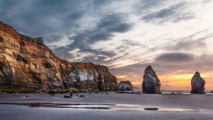
Данные предыдущих подводных исследований позволили выявить места предыдущей гидротермальной активности и активных подводных просачиваний гидротермальных флюидов. Эти результаты, а также аэрофотосъемка, проведенная в начале 2023 года с использованием системы SkyTem, помогают составить карту прошлой и настоящей гидротермальной активности на всем вулкане. Эта информация используется для создания точных трехмерных моделей, показывающих участки ослабленных горных пород и места прошлых оползней. Это очень важно, поскольку оползни могут вызвать извержение вулкана или цунами.

«Получение изображений недр способствует надежному численному моделированию и моделированию, которые мы начинаем использовать для оценки множества возможных сценариев развития вулканических событий в заливе Пленти в будущем», — говорит Крейг. «Если мы сможем определить вероятность и последствия этих вулканических опасностей, мы сможем лучше подготовиться к ним в случае их возникновения».

Программа Beneath the Waves — это инициатива, реализуемая под руководством GNS при участии сотрудников различных университетов и организаций по управлению чрезвычайными ситуациями.

Related Articles